
- Mar 11, 2026
- Sandon Law
- Uncategorized
- 0 Comments
The world around us is three-dimensional, yet for centuries, we have relied on two-dimensional plans to design, build, and document it. This process is prone to error, time-consuming, and often fails to capture the full picture. Today, technology has caught up with reality. 3D laser scanning has revolutionized how we measure and visualize physical spaces, transforming complex environments into precise digital models with incredible speed and accuracy.
This guide explains everything you need to know about this game-changing technology. We will explore how it works, its major benefits, and its diverse applications across industries. Whether you are an architect, engineer, project manager, or simply curious about the future of digital reality, this complete guide will help you understand the power of 3D laser scanning.
What Is 3D Laser Scanning?
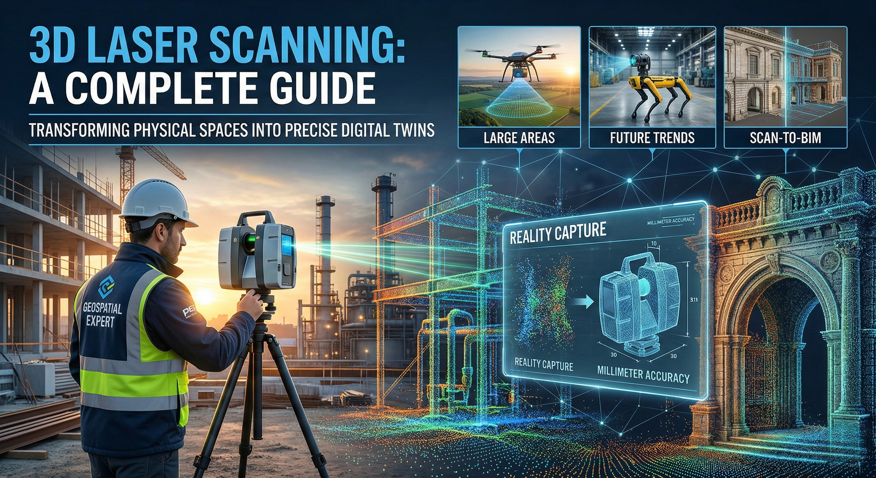
At its core, 3D laser scanning is a non-contact, non-destructive technology that digitally captures the shape of physical objects using a line of laser light. The process creates a “point cloud,” which is a massive data set made up of millions or even billions of individual measurement points. Together, these points form a highly detailed and accurate 3D representation of the scanned object or environment.
This digital copy, often called a “digital twin,” can be used for analysis, design, measurement, and documentation. It effectively bridges the gap between the physical and digital worlds, allowing professionals to work with a precise digital replica of a real-world site from their computers.
How Does 3D Laser Scanning Technology Work?
A 3D laser scanner works by emitting a laser beam that hits the surface of an object. The scanner’s sensor then measures the time it takes for the laser to bounce back. Since the speed of light is a known constant, the scanner can calculate the exact distance to that point with incredible precision.
The scanner repeats this process millions of times per second, rotating 360 degrees and vertically to capture everything in its line of sight. Each measurement point is recorded as a coordinate in 3D space (X, Y, Z), creating the dense point cloud that maps the entire environment.
The Role of LiDAR in Modern Surveying
The technology powering most 3D laser scanners is LiDAR, which stands for Light Detection and Ranging. While the term is often used interchangeably with 3D laser scanning, LiDAR is the underlying method of measurement. It has become a cornerstone of modern surveying because it provides a much faster and more comprehensive way to collect data compared to traditional manual methods.
Understanding Point Cloud Data and Reality Capture
Reality capture is the process of capturing the physical world and converting it into a digital model, and point clouds are the direct output. Initially, a point cloud is just a massive collection of dots. Specialized software is used to process this raw data, cleaning it up and aligning multiple scans together. The resulting model is a dimensionally accurate digital replica of the as-built conditions of a site.
Key Benefits of Using 3D Laser Scanning
Adopting advance 3d laser scanning offers significant advantages over traditional measurement techniques, making it an invaluable tool for countless projects.
Improving Accuracy and Reducing Human Error
Manual measurements with tape measures or total stations are susceptible to human error and can miss complex details. A 3D laser scanner captures data with millimeter-level accuracy, providing a reliable and comprehensive dataset that eliminates guesswork and ensures plans are based on precise, as-built conditions.
Saving Time and Costs on Construction Projects
A single person can scan a large and complex site in a matter of hours, a task that might take a team of surveyors days to complete manually. This rapid data collection reduces time on-site and minimizes disruptions. The high accuracy of the data also prevents costly rework during construction caused by design clashes or inaccurate initial surveys.
Enhancing Collaboration With Digital Twins
Point cloud data can be shared easily among project stakeholders, regardless of their location. Architects, engineers, and contractors can all work from the same digital twin, improving communication and ensuring everyone is on the same page. This level of collaboration leads to better decision-making and more efficient project execution.
Safety Advantages in Hazardous Environments
Scanning is a remote process, meaning operators can capture data from a safe distance. This is a crucial advantage when documenting hazardous or inaccessible areas, such as industrial plants with active machinery, structurally unsound buildings, or busy roadways. It reduces the need for workers to enter dangerous environments.
Common Applications Across Industries
The versatility of 3D laser scanning has led to its adoption in a wide range of fields.
3D Scanning for Architecture, Engineering, and Construction (AEC)
In the AEC industry, scanners are used for as-built documentation, construction verification, and creating Building Information Models (BIM). Architects can design renovations with confidence, knowing they have exact measurements of the existing structure.
Industrial Plant Maintenance and Facility Management
For complex facilities like power plants or factories, 3D scanning helps create accurate models for maintenance planning, clash detection during retrofits, and equipment layout optimization.
Historical Preservation and Heritage Documentation
Laser scanning provides a way to digitally preserve historical buildings and artifacts with incredible detail. These digital models can be used for restoration, academic research, or creating virtual tours for the public.
Real Estate Virtual Tours and Floor Plans
Scanners can quickly generate accurate floor plans and immersive 3D virtual tours for real estate listings. This gives potential buyers a realistic sense of the property before they even visit.
Types of 3D Laser Scanners and Equipment
Different projects require different tools. The type of scanner used depends on the size of the area, the level of detail needed, and site accessibility.
Terrestrial Laser Scanners vs. Mobile Mapping Systems
Terrestrial laser scanners are stationary devices mounted on a tripod. They are ideal for high-accuracy applications where detail is paramount. Mobile mapping systems are mounted on vehicles or carried in a backpack, allowing for rapid scanning of large areas like city streets or long corridors, though often with slightly lower accuracy.
When to Use Handheld 3D Scanners
Handheld scanners are perfect for capturing detailed information about smaller objects or navigating tight, confined spaces. They offer flexibility but are less suited for scanning large buildings or landscapes.
Drone-Based LiDAR Scanning for Large Areas
When a project covers a vast area, like a new land development or a large construction site, mounting a LiDAR scanner on a drone is the most efficient method. It provides a comprehensive topographical survey from the air.
The 3D Scanning Workflow: From Field to Finish
The process doesn’t end when the scanner is turned off. Turning raw data into a usable model involves several key steps.
Planning the Scan: Site Conditions and Requirements
Before starting, a plan is made to determine the optimal scanner locations to ensure full coverage and avoid data gaps. Factors like lighting, weather, and site access are all considered.
Data Registration: Stitching Scans Together
Most projects require multiple scans from different positions. Data registration is the process of aligning and “stitching” these individual point clouds together to create one cohesive and accurate model of the entire site.
Scan-to-BIM: Converting Point Clouds Into 3D Models
The final step is often to convert the point cloud into a usable 3D model, such as in Revit or AutoCAD. This Scan-to-BIM process involves tracing over the point cloud data to create intelligent objects like walls, pipes, and structural elements.
3D Laser Scanning Costs and Commercial Considerations
Understanding the financial aspects is crucial for project planning.
How Much Does 3D Laser Scanning Cost?
The cost of 3D laser scanning services can vary widely, from a few thousand dollars for a small project to tens of thousands for a large, complex facility. Pricing is typically based on the project scope, time on-site, and deliverables required.
Factors That Influence Pricing for Scanning Services
Key factors include the size and complexity of the site, the required level of detail (LOD), site accessibility, and the type of final deliverables (e.g., raw point cloud vs. a fully developed 3D model).
Buying Equipment vs. Hiring Professional Scanning Services
For companies that need scanning frequently, buying equipment might be cost-effective in the long run. However, the high cost of hardware and software, plus the need for trained operators, makes hiring a professional service like engrx.ca the more practical choice for most businesses.
Finding 3D Laser Scanning Services Near Me
Choosing the right partner is critical to project success.
How to Choose a Local Laser Scanning Company
Look for a provider with a proven track record, relevant industry experience, and positive client testimonials. Ensure they use modern equipment and have skilled technicians who can manage the entire workflow.
Questions to Ask a Surveying Provider in Your Area
Ask about their experience with similar projects, the specific equipment they use, their data processing workflow, and what deliverables you can expect. Clear communication is key.
Regional Regulations and Surveying Standards
Depending on your location and project type, there may be specific surveying standards or regulations that need to be met. A reputable local provider will be familiar with these requirements.
Future Trends in 3D Capture Technology
The technology is constantly evolving, with new advancements making it even more powerful.
The Integration of AI in Point Cloud Processing
Artificial intelligence is being used to automate the classification of points in a cloud, identifying objects like walls, floors, and pipes automatically. This dramatically speeds up the Scan-to-BIM process.
The Rise of Autonomous Mobile Scanning Robots
Robots equipped with scanners, like Boston Dynamics’ Spot, are being deployed to autonomously scan sites regularly. This allows for continuous progress monitoring and keeps digital twins constantly updated.
Frequently Asked Questions
How Accurate Is a 3D Laser Scanner?
High-end terrestrial scanners can achieve an accuracy of +/- 1-2 millimeters. The level of accuracy depends on the quality of the equipment and the distance from the scanner to the object.
How Long Does It Take to Scan a Building?
The time required depends on the building’s size and complexity. A typical commercial building might take one to two days to scan, while a large industrial plant could take a week or more.
What Is the Difference Between Photogrammetry and Laser Scanning?
Photogrammetry creates 3D models from a series of photographs. It is generally less accurate than laser scanning but can capture color and texture very well. Laser scanning excels in dimensional accuracy, while photogrammetry is often used for visual representation.
Do I Need Specialized Software to View Scan Data?
While creating and manipulating point clouds requires powerful software, many providers offer free, lightweight viewers that allow clients to view, navigate, and take basic measurements from the point cloud data on a standard computer.